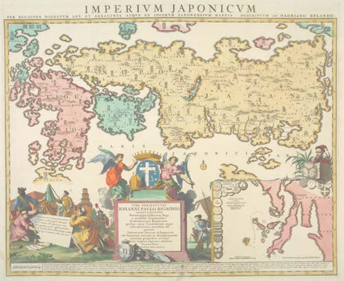
 | Adrien Reland.
Imperium Japonicum per Regiones Digestum Sex et Sexaginta atque ex Ipsorum Japonensium Mappis.
£1800.00
Amsterdam, Joachim Ottens, 1740. 495 x 605mm. Coloured. An important map, the first Western map of Japan with Sino-Japanese characters. It is also extremely decorative with the lower third of the sheet taken up with an extensive title cartouche featuring Chinese figures and an inset chart of Nagasaki harbour.
RELA0001
Enquire
This is a genuine antique print, published at or about the date specified, but guaranteed over 250 years old.
We provide a certificate of authenticity with all purchases.
We offer free standard postage in the UK.
Please enquire about overseas postage. |

